










LandLens Home
Land Lens

Welcome Back

Sign in to continue to dashboard

By continuing, you agree to our Terms, Privacy Policy & Refund Policy

Land intelligence for Tamil Nadu

Every land question in Tamil Nadu, answered from the registers.

Who owns it, what is registered against it, what it is worth and what can be built on it. LandLens reads the revenue, registration and planning registers for you, and answers with the record, its date and its source.

Every day, 15,000+ users trust us

  • Sign in with a WhatsApp OTP
  • 35tools stay free
PriceMap25 years
₹6,480per sq ft, registered
2001200920172026
Verify My Land
  • Owner matches the seller
  • No open encumbrance
  • Zone allows housing
  • No court case found
One Map33 layers
CoastAirportLand use
EncumbranceS.No. 112/5
  • 2011Sale deedDoc 1842
  • 2016MortgageDoc 977
  • 2021Receipt, loan closedDoc 2310
No open encumbrance
Guideline valueFree
₹3,200 per sq ft
2007201220172024
Property Tracker

Illustrative records. Your results come from the live registers.

Trusted by leading developers, banks, legal firms and property buyers across Tamil Nadu.

Hiranandani Brigade Sobha Casagrand SIS VGN Godrej Puravankara DAC DRA Homes
  • ₹100Cr+Money saved
  • 10K+Properties verified
  • 100k+Hours saved
  • 50K+Documents it was trained on

What is LandLens

LandLens is a land intelligence platform for Tamil Nadu. It reads the government's revenue, registration and planning registers, and the Acts, rules, government orders and gazette notifications that govern land, and answers any question about a plot with the record itself: dated, cited and ready to act on.

The LandLens suite

Nine products. One ground truth.

From a free one-line answer to a full legal opinion, every product reads the same registers, so the answers agree with each other.

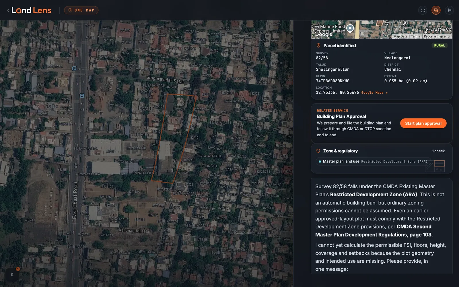
LandLens One Map: a survey parcel outlined on satellite imagery with survey numbers, and beside it the conversation naming the parcel, its master plan zone and the cited answer
Start here

LandLens One

Ask Veritas anything about Tamil Nadu land. Answers from the law, cited to the page, and it acts on the records. One Map puts the conversation beside the parcel itself.

Price shown before every runAsk Veritas
LandLens Minis

86 one-question tools over the registers: guideline value, patta, EC, zones, stamp duty. The price shows before it runs, and many are free.

Verify My Land

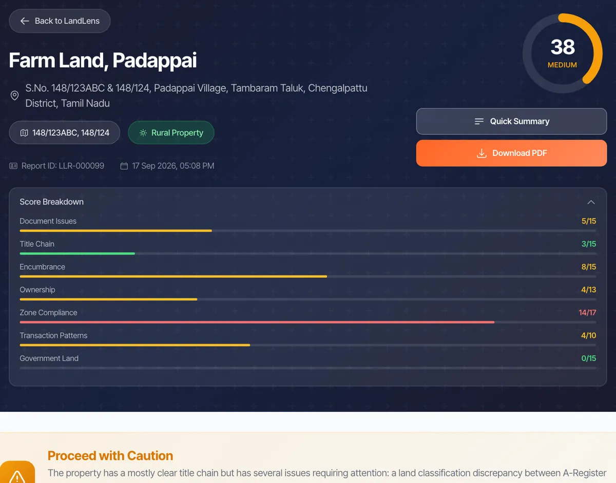
33+ automated legal checks. EC fetch, ownership verification, zone restrictions. All in one report.

Legal Opinion

AI-powered legal due diligence. Get comprehensive title verification and property risk assessment.

10 credits, up to 100 pagesGet a legal opinion

Property Tracker

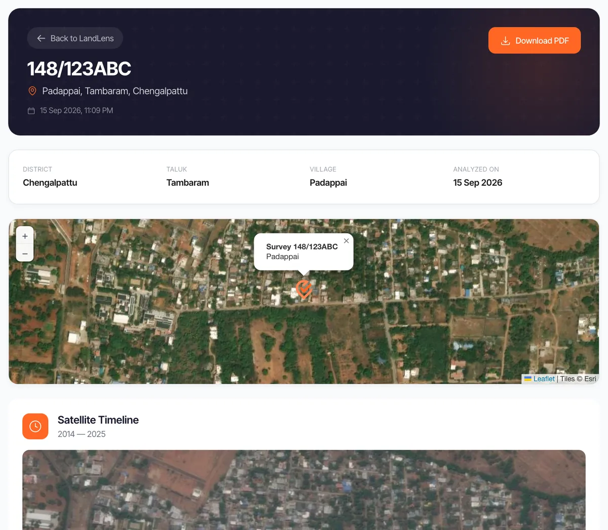
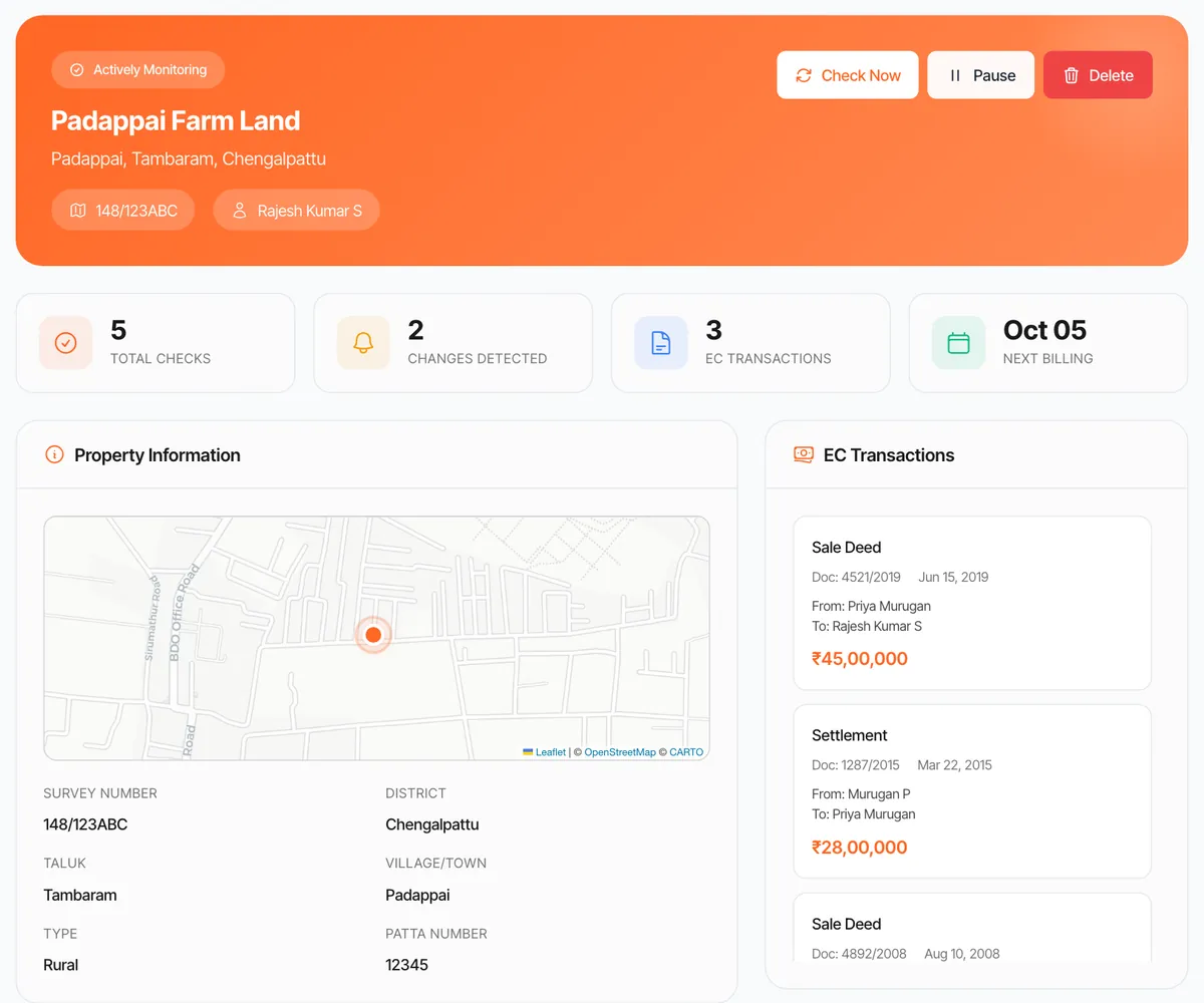
Monitor any property for changes. Get alerts on new registrations, EC updates, and ownership changes.

4 credits per property a monthTrack a property

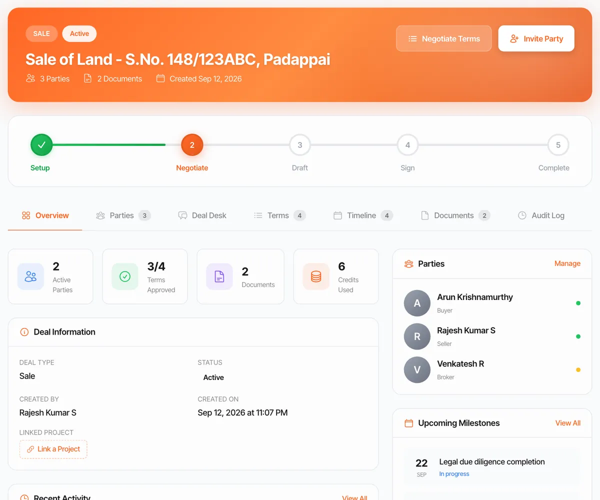
Deal Room

Secure transaction workspace. Document sharing, e-signatures, milestone tracking, from offer to registration.

Free to createOpen a deal room
Works inside your AI

API and MCP

Connect Claude, ChatGPT or Perplexity to the registers, or call the same checks from your own code over plain HTTPS. You approve the spend, and a check that finds nothing is not charged.

Same credits as the toolsConnect your AI
One Map

33 layers over one plot.

Drop a pin. One Map lays every restriction that touches the land over the cadastral map, from water bodies to the airport funnel, and tells you plainly which ones apply.

Switch a layer on. Read the verdict.

Open One Map
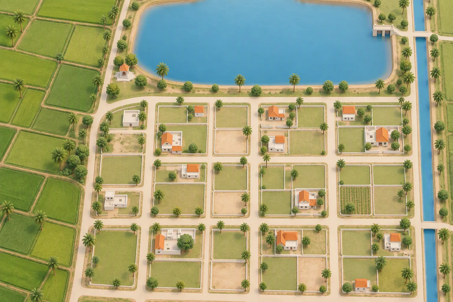
Illustrated map of a town edge in Tamil Nadu: a grid of house plots below an irrigation tank, a canal on the east and paddy fields on the west S.No. 112/5 33 layers, 7 groups
Clear of water bodiesThe tank and the canal do not touch this survey
Outside the coastal regulation zoneThe canal's tidal buffer stops short of the plot
Outside the regulated bandNot on the temple or Waqf registers either
Road widening proposed on the frontageCheck the setback before you build
Primary residential, with a height capThe plot sits under an airport approach funnel
Not reserve forest, hill area or defence landNo eco-sensitive zone or quarry nearby
No transmission corridor across the plotThe nearest high tension line crosses the fields to the west
LandLens Minis

One question. One answer.

86 focused tools over the revenue, registration and planning registers. 35 are free and stay free. A paid mini names its price, shows your balance and waits for your yes.

What it reads

The ten checks behind every report.

Each check reads a government register or a court index, and each result carries its source and its date.

  • 86tools over the registers, 35 of them free
  • 33map layers, from water bodies to airport funnels
  • 25 yearsof registered sale prices
  • 460,000+digitised archive records for tracing old titles
  • 11,500+Acts, rules, government orders and gazette notifications
  • 33+automated checks in one Verify My Land report
  • EC and title trail

    Every registered transaction on the survey, read in order, so a break in the chain shows up.

  • CERSAI mortgage check

    A live search of the national security interest registry for loans against the property.

  • Court cases

    Civil and revenue court searches by party name, survey number and case number.

  • Zoning and restrictions

    Master plan land use, with coastal, airport, heritage and water body rules at the plot.

  • Environment and risk

    Flood extents, catchments, eco-sensitive zones, reserve forest and hill area limits.

  • Pending dues and utilities

    Property tax, water tax and electricity records, where the local body publishes them.

  • Document completeness

    What your file holds, what it is missing, and which office issues the missing piece.

  • Temple and Waqf land

    The temple land register and the Waqf Board register, checked by survey number.

  • Building approvals

    CMDA, DTCP and local body approvals, completion certificates and RERA registrations.

  • Certified copy and comparison

    The certified copy from the registration department, compared line by line with the document you were given.

Who it is for

Same registers. Different questions.

  • Illustration of a couple beside a plot of land with boundary stones and a map pin

    Property buyers

    Before the advance: who owns it, what is registered against it and what can be built on it.

  • Illustration of an advocate reading a document, a ribboned bundle of deeds on the desk

    Lawyers and law firms

    Registers, government orders and case notes in one place, cited to the page. The drafting starts sooner.

  • Illustration of a bank officer holding a property document beside a shield with a check mark

    Banks and NBFCs

    Title, mortgage registry and court checks on every loan file, at the same depth each time.

  • Illustration of a site engineer and a developer over a layout plan

    Builders and developers

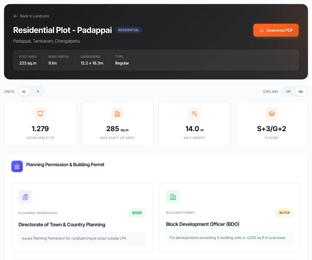
    FSI, setbacks, road width and the height cap before you option the land, not after the architect bills you.

  • Investors

    Screen ten plots in an evening. Registered sale prices, zoning and encumbrances, without ten site visits.

  • Families tracing old land

    Current registers searched together with 460,000+ digitised archive records, village by village.

  • NRIs

    Run every check from abroad, then keep a tracker on the property after you buy.

Credit-based pricing

Simple, transparent pricing. Pay per property.

10 credits is one complete due diligence, up to 100 pages and 3 survey numbers. Extra pages are 4 credits per 50. Extra surveys are 2 credits each.

Save up to 20%

Starter

Perfect for individual property buyers verifying a single property.

₹999₹899 one-timea month
10 credits
  • 1 LandLens Due Diligence Report
  • 2 Verify My Land checks
  • 2 PriceMap valuations
  • 2 Build Scope analyses
  • 2 Property Tracker monitors
  • Deal Rooms, free to create
  • Email support

Professional

Most popular

Ideal for lawyers and firms handling multiple properties regularly.

₹8,999₹8,499 ₹9,999 one-timea month
100 credits
  • 10 LandLens Due Diligence Reports
  • 25 Verify My Land checks
  • 25 PriceMap valuations
  • 25 Build Scope analyses
  • 25 Property Tracker monitors
  • Unlimited Deal Rooms
  • Priority WhatsApp support

Business

For banks, NBFCs, and large organizations with high volume needs.

₹84,999₹79,999 ₹99,999 one-timea month
1,000 credits
  • 100 LandLens Due Diligence Reports
  • 250 Verify My Land checks
  • 250 PriceMap valuations
  • 250 Build Scope analyses
  • 250 Property Tracker monitors
  • Unlimited Deal Rooms
  • Dedicated account manager

What a credit buys

The price shows before anything runs.

  • 0 to 4A mini
  • 4Verify My Land
  • 4PriceMap
  • 4Build Scope
  • 4 a monthTracker, per property
  • 10Legal Opinion
  • 10Certified copy
  • FreeDeal Room

Enterprise. Data sovereignty, team roles and one shared credit pool, from ₹99,999 a month.

Talk to us
In their words

What customers say.

From the people who use LandLens on their own land and deals.

  • One Map
    What used to take us weeks now takes hours. Ownership, encumbrances, coastal rules, temple and Waqf land, flood zones, litigation: one map instead of a round of government offices. And it was built here, for Tamil Nadu records specifically.
    Ranjeeth Rathod DRA Homes
  • Legal Opinion FORTUNE GLOBAL 500 · COMPANY · 500
    We are an international property consultancy. LandLens runs our entire due diligence workflow: every property we clear for our international corporate clients and high net worth individuals goes through their tools first.
    International property consultancy Name withheld under NDA
  • Enterprise FORTUNE GLOBAL 500 · COMPANY · 500
    We gave them every constraint: zoning, area, size, and the shortest distance from three of our other offices. They built a tool just for us that lit up every property matching the filter. We shortlisted a few, and they closed the deal with the owner of the best option they had suggested.
    Global technology company Name withheld under NDA
  • Verify My Land
    We were about to buy 28 acres at the full price. Then LandLens showed us that 9 of those acres could not be developed because of restrictions, so we renegotiated and closed the deal. Their team helped with the negotiation and the complete transaction as well.
    Mukund Vishvkarma MSA Global Logistics
  • Legal Opinion
    I never thought I would be able to do comprehensive due diligence on any property in hours. It used to take days of hard work and back-to-back visits to so many sites and offices.
    Vigneswar Venkatesan Advocate, Vignesh Law Chambers
  • Legal Opinion
    Whatever we threw at it came back with beautiful results. We did the due diligence on a property with more than 100 survey numbers in no time.
    Srinath Ra Iyengar Advocate, Fox Mandal
  • Verify My Land
    Every site we take on goes through Verify My Land before the token advance. The report is back in minutes, and it names the registers it read.
    Thiyagarajan SVS Oil
  • PriceMap
    Before we sold our land we read 25 years of registered prices around it on LandLens. We walked into the negotiation knowing exactly what the buyer knew.
    Manoj MSM Dhall Mill
  • Property Tracker
    I live in California and every property I own back home is on Property Tracker. The day anything is registered against one of them, I know, on WhatsApp, without a single call to Chennai.
    Sanjay Srinivasan NRI, California, USA
Questions

Commonly asked questions.

What is LandLens?

LandLens is a land intelligence platform for Tamil Nadu, built by Verified.RealEstate. It reads the government's revenue, registration and planning registers, and the Acts, rules, government orders and gazette notifications that govern land, and answers questions about a plot: who owns it, what is registered against it, what it is worth and what can be built on it. Every answer names its source and its date.

Which records does LandLens check?

Patta, chitta, the A-register and town survey records for ownership. Encumbrance certificates for registered transactions. Guideline values and 25 years of registered sale prices. Master plan land use, with coastal, airport, heritage and water body restrictions. Planning approvals, RERA registrations, court cases and the national mortgage registry. Behind every check, the Acts, rules, government orders and gazette notifications that govern land in Tamil Nadu, cited to the page.

Is LandLens free?

35 of the 86 Minis are free and stay free, including guideline value, stamp duty, the land unit converter and the sub-registrar office finder. Paid tools cost 1 to 4 credits and show the price before they run. Reports cost 4 to 10 credits.

How much does a credit cost?

A Starter pack is ₹999 for 10 credits. Professional is ₹8,999 for 100 credits and Business is ₹84,999 for 1,000 credits. Monthly plans cost less per credit. 10 credits cover one complete due diligence of up to 100 pages and 3 survey numbers.

Does LandLens replace a lawyer?

No. LandLens does the fetching, reading and cross-checking that takes days by hand, and gives you a cited report. For a purchase, take that report to your advocate, or order a lawyer's legal opinion from Verified.RealEstate. See the legal opinion service.

Does it cover all of Tamil Nadu?

LandLens is built only for Tamil Nadu. Ownership, encumbrance and guideline value lookups work across the state. Some planning layers cover specific areas, such as the Chennai master plan, and each result names the register it came from.

Can I use LandLens inside ChatGPT or Claude?

Yes. LandLens runs as an MCP server, so Claude, ChatGPT and Perplexity can run the same checks from a conversation. You approve the spend, and a check that finds nothing is not charged. Developers can call the same tools over a plain HTTPS API. See the set-up guide.

Is my data safe?

Documents are encrypted in transit with TLS 1.2 or higher, and the platform sits behind Cloudflare. Enterprise plans can keep their data in their own database. Read the data security page.

Start today

Know the land before you pay the advance.

Begin with the free tools. Move to a full report when the deal gets serious.

  • Sign in with a WhatsApp OTP
  • 15,000+ users every day
Illustration of a plot of land under a magnifying glass, with a boundary stone, a map pin and checked documents